The name "Attawandaron" came from the word "Attawandaronk" which was given to them by the Huron and Iroquois meaning "they are those whose language is awry". In time, Christianity was brought to the area, the remains of a Jesuit Chapel has been discovered in the territory.
The balance of power which brought peace and prosperity to the Neutrals did not last when the Huron Nation was defeated and dispersed by the triumphant Iroquois. The Attawandaron, too, were attacked and dispersed by fleeing west with the remainder of the Hurons and Tobacco, eventually to become fused and known as the Wyandotte. The years were 1650-51.
Legend tells of a great massacre having taken place at Northville, west of the camp where the Attawandaron Chief had been challenged to a battle by the Iroquois Chief and having defeated him was fallen upon, with all his people, by the disappointed and vengeful Iroquois who killed them by the scores. It is said that the sad remains of this battle form the pieces of bone and weapons still discovered from time to time by the residents in the area.
Modern warfare came to the Pinery lands during the Second World War as it was frequently crossed by truck and armour of the Canadian Army on maneuver from near by Camp Ipperwash. Piles of empty shell casings are still sometimes found as evidence of this history, like the flint chips of the Indians are evidence of their conflicts.
The Sarnia Boy Scout Camp remained part of the remaining parcel of the Canada Company until it was purchased by the Sarnia Boy Scout Association in the mid 1940's. The lands had been used for Scout camping for many years, by Nelson Allen and others, but had not been improved until two hundred and thirty-seven acres on both sides of the Ausable Cut were acquired after a campaign for funds.
Originally the Ausable River had it's water course through the Grand Bend and thetraveled through what is now the Pinery Provincial Park. The stream on the north boundary of Camp Attawandaron was the original Ausable River. The Ausable Cut was created to alleviate flooding of the Bosanquet Township and in the 1890's it was George Parker. Subsequent to the purchase, part of the Scout Camp lands on both sides of the “Cut” was expropriated by the Ausable Conservation Authority.
Eventually, two leases were negotiated to establish the present boundaries of the camp which extends from the north limit to the Ausable River and to Highway 21 on the south, from its west limit on the Ausable Cut, and its east limit being the Pinery Provincial Park. With its sand dunes and great variety of trees and plant life, some of itvery rare, with its good swimming and abundant of winter activity, the Sarnia Boy Scout camp is fast becoming desirable and has proven to be a delight for Scouts within a wide portion of south-western Ontario as well as from parts of the United States.
A Scout Camp becomes a reality.
The Sarnia District Association purchased from the Canada Company two hundred and thirty-one acres of land, comprising of forty-seven acres is located on the west of the Ausable River Cut with the balance on the east side and adjacent of the PineryProvencial Park for three thousand dollars. President Paul Bradley and George Parker negotiated on behalf of the Association. The deed was registered on May 5th 1948, at the Lambton County Registry Office under the Instrument number 19004.
On November 20th. 1948 Mr. and Mrs. George McIntyre were honoured by the Group Committee, Scouts and Cub leaders, their assistants and officers of the ladies Auxiliary of Devine St. United Church for their work in the camp.
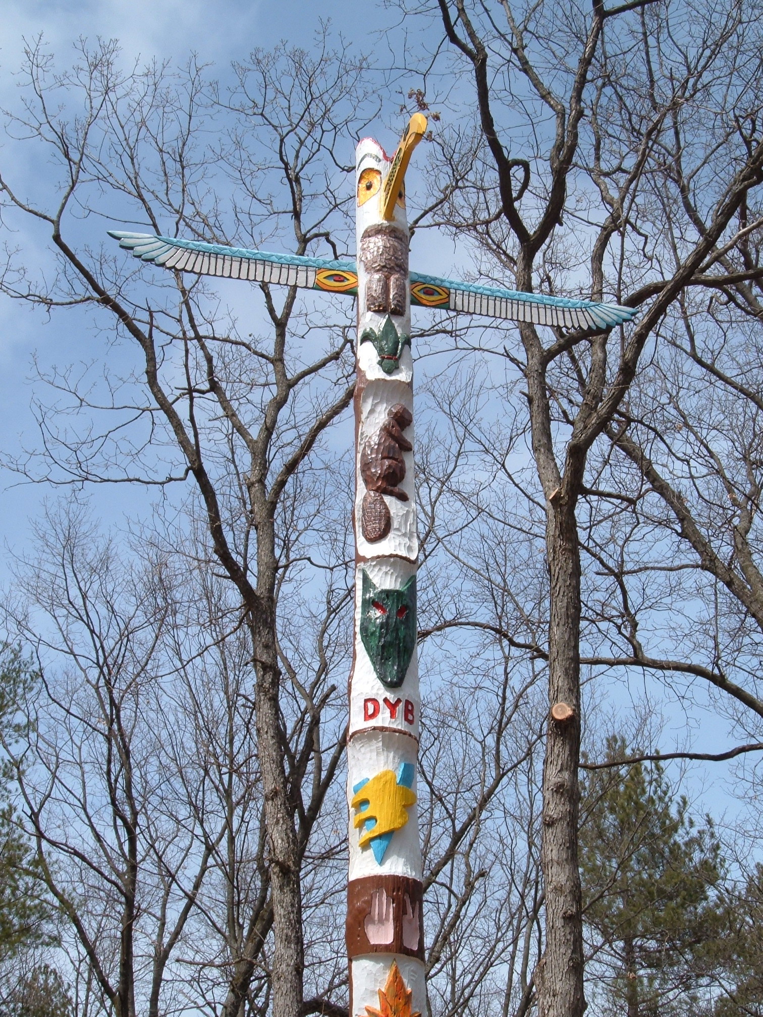
How the Totem Pole came into being created